In this section you can analyze and download the most suitable route for your driving characteristics. For each route it is possible to evaluate difficulties, length, altimetry, points of interest along the route, points of recovery on asphalt, points of recharge batteries.
All the paths of Monte Carmo Outdoor have been designed to offer the user the opportunity to explore this fantastic territory in complete autonomy and in total safety.
Castagna Banca
Profile
No data elevation
Name:
No data
Distance:
No data
Minimum elevation:
No data
Maximum elevation:
No data
Elevation gain:
No data
Elevation loss:
No data
Duration:
No data
Description
Add here your formated description
Pineta Family Trail
Profile
No data elevation
Name:
No data
Distance:
No data
Minimum elevation:
No data
Maximum elevation:
No data
Elevation gain:
No data
Elevation loss:
No data
Duration:
No data
Description
Add here your formated description
Balestrino
Profile
No data elevation
Name:
No data
Distance:
No data
Minimum elevation:
No data
Maximum elevation:
No data
Elevation gain:
No data
Elevation loss:
No data
Duration:
No data
Description
Add here your formated description
Stazione di Ricarica e-bike
Latitude:
44° 09' 17"
Longitude:
8° 14' 09"
Description
Qui puoi ricaricare la tua e-bike, sono disponibili 4 prese
PDI Castagna - Borgata
Latitude:
44° 09' 25"
Longitude:
8° 14' 06"
Description
Antica chiesa interesse storico e presenza fontanella acqua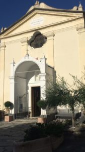
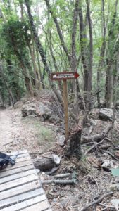
Punto di Recupero 1
Latitude:
44° 10' 03"
Longitude:
8° 13' 39"
Description
Punto di recupero mezzo soccorso fine asfalto verso a Martino
PDI Castagna - Addestramento Cani
Latitude:
44° 10' 04"
Longitude:
8° 13' 18"
Description
Punto panoramico e zona addestramento cani
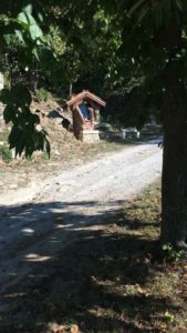
PDI Castagna - Mistico
Latitude:
44° 10' 05"
Longitude:
8° 13' 10"
Description
Inizio tratto mistico con manufatti religiosi contemporanei
Punto di Recupero 2
Latitude:
44° 10' 11"
Longitude:
8° 12' 58"
Description
Parcheggio castagna termine ascesa ed inizio trail. Punto di recupero per mezzi soccorso.
PDI Castagna - Ponte Romano
Latitude:
44° 09' 21"
Longitude:
8° 13' 53"
Description
Ponte romano
Punto di Recupero 3
Latitude:
44° 09' 33"
Longitude:
8° 13' 43"
Description
Fine karma punto di recupero mezzo soccorso
PDI Castagna - Mulino
Latitude:
44° 09' 16"
Longitude:
8° 13' 58"
Description
Vecchio Mulino

PDI Castagna - Santa Libera
Latitude:
44° 08' 51"
Longitude:
8° 13' 54"
Description
Punto panoramico Santa Libera
PDI Castagna - Borgata
Latitude:
44° 07' 57"
Longitude:
8° 15' 22"
Description
Antica borgata di Interesse storico Borgo castello
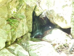
PDI Castagna - Grotta di Ulisse
Latitude:
44° 09' 48"
Longitude:
8° 12' 57"
Description
Suggestiva grotta nascosta